Photo by Graeme Edwards
REEFTON
The present-day Warburton to Woods Point Rd was a rough track in the late 1890s. It passed through the small settlement of Walsh's Creek, where McVeighs Hotel was located. In 1898, a coach service operated between Warburton and McVeighs and was later extended to Woods Point. The track to Wood's Point, as well as Walsh's Creek and McVeighs, was submerged when the Upper Yarra Reservoir was built.
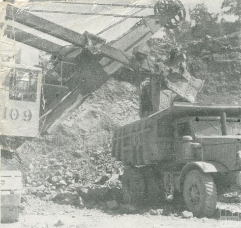
After delays caused by World War II and another two summers of water restrictions in 1945 and 1946, construction began on the Upper Yarra Reservoir and a major scheme of pipelines and tunnels to bring more water to Melbourne. This was at the confluence of Walsh’s Creek and the Yarra River, 20 km east of Warburton.
Many single men were attracted to the site, particularly migrants from Yugoslavia, Albania, England, Scotland, Ireland and Italy. Italians disembarking at Princes Pier were even recruited as they stepped off the ships, those from farming backgrounds being favoured for the work. Some of the new arrivals were unable to speak much English, and apparently workers wore numbers to identify themselves.
Despite the mixture of nationalities at the temporary township, however, there was little conflict, and it has been called "a conspicuously successful piece of social engineering". Indeed, workers cultivated a particular pride in "our dam", and held what was known as "the Upper Yarra Star", with ex-Upper Yarra employees reputedly being "given first preference on other jobs".
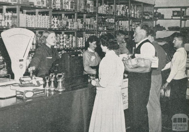
A new road was constructed from Warburton to bring plant and materials to the dam site, and site preparation began in 1949. The workforce was to be accommodated on site and domestic quarters were built for single men, families and staff/management. There were also kitchens, laundry facilities, mess areas, canteen, recreation hall and a co-op store.
One of the first houses was seconded for McVeigh’s school (1950) renamed Upper Yarra Dam school when a proper building was constructed in 1951. There were sports teams, a Country Women’s Association branch, Scouts and Guides. The school’s maximum enrolment of 102 was in 1956.
The dam was opened in 1957, with a surface of 1830 acres supplied by a catchment of 81,060 acres. House removals began the year the dam was opened, but the mess hall was kept for day trippers to the dam.
McVeigh's water wheel is in the grounds of the Upper Yarra Dam park. The gears and iron work are the only remaining original parts as the rest has been rebuilt. McVeigh's water wheel started its life in the 1890s running equipment at the Contention Mine in Contention gully located about 13 km up stream from the current Upper Yarra Dam wall. This was one of many mines in the area. An information board at the main picnic area at the Dam describes the history of McVeighs.
One of Melbourne’s largest water storages, its well-maintained surrounds are popular with picnickers and campers alike. Cumberland Junction offers a choice between heading back via Marysville (perhaps along the magical Acheron Way) or delving deeper into wild forest toward Big River, Matlock and Woods Point.
Melbourne Water has upgraded and completed dam remediation works of the Upper Yarra Dam. Upper Yarra Reservoir Park (campground, day use area and walking tracks) will remain closed until 2022.
Residents in Reefton and McMahons Creek have an active Community Group.
Source:
‘Upper Yarra Dam’, Victorian Places, 2014, accessed on 24/10/2021
Further reading:
Val Smith, Upper Yarra Dam: a pictorial history, Wesburn, 1995
Shirley Tunaley, Upper Yarra Dam: a 1950s construction town, Yarrambat, 2007
Area profile for Rural South and East
.png)


